
The Qhapaq Ñan is undoubtedly the most extensive Inca road network that remains as a legacy from our ancestors. The Inca Empire managed to build roads throughout Peru, extending as far as Chile, Bolivia, Ecuador, Colombia, and Argentina in just over 100 years. Each of these paths holds stories we still do not know. However, we can still enjoy their importance by traveling along the greatest masterpiece of the Americas.
Due to its cultural significance, the Qhapaq Ñan was declared a UNESCO World Heritage Site on June 21, 2014. Below, we will learn more about the most important road network of the Inca Empire, which continues to amaze us to this day.
- 1. History and Meaning of the Qhapaq Ñan
- 2. What Is the Qhapaq Ñan?
- 3. Who Built the Qhapaq Ñan?
- 4. Where Are the Qhapaq Ñan Roads Located and to Which Regions Do They Lead?
- 5. Why Is the Qhapaq Ñan Important?
- 6. The Qhapaq Ñan Today
- 7. What Can I See on the Qhapaq Ñan?
- 8. The Inca Trail to Machu Picchu
- 9. The Salkantay Trek to Machu Picchu
- 10. Frequently Asked Questions about the Qhapaq Ñan
- You may be interested:
1. History and Meaning of the Qhapaq Ñan
The qhapaq ñan, translated from Quechua as “Road of the Lord” or “Royal Road,” was the backbone of the Inca Empire. This road system connected thousands of kilometers of territory, facilitating the political, economic, and cultural unity of the Tahuantinsuyo.
Its use was reserved for the nobility, the armies, imperial administrators, mitimaes, and the famous chasquis. The latter were specialized messengers who ran at high speed along sections of the road to transmit crucial information throughout the Inca Empire.
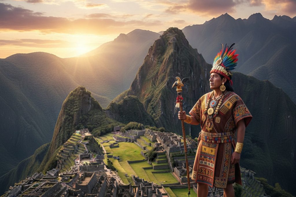
Pachacútec and the Consolidation of the Qhapaq Ñan
The history of the Qhapaq Ñan is closely linked to the reign of Pachacútec, one of the most visionary rulers of the Inca Empire. Pachacútec was likely the one who designed the strategy for the Inca Empire location expansion and ordered the improvement and extension of pre-existing routes.
The objective was clear: to connect the four regions or suyus of the Tahuantinsuyo, ensuring the movement of troops, trade, and effective administration. His successors, Tupac Inca Yupanqui and Huayna Cápac, continued the work, extending the routes to more remote areas.
Beyond its practical function, the qhapaq ñan had symbolic value. Many of its routes led to sacred shrines and mountains, considered points of connection between the earthly and spiritual worlds in the Andean worldview.
This network served both to consolidate the control of the Inca Empire and to strengthen the religious practices that united the various cultures integrated into the Inca location.
On June 21, 2014, the Qhapaq Ñan was declared a UNESCO World Heritage Site, recognizing its value as one of the most impressive Inca road systems in pre-Hispanic history.
Today, it remains a symbol of the engineering, organization, and unifying vision of the Inca Empire. Through its routes, it is still possible to traverse the same landscapes that once connected peoples and cultures under the vast territory of the Tahuantinsuyo.
2. What Is the Qhapaq Ñan?
The Qhapaq Ñan was the backbone of the Inca Empire, a road network that integrated the most diverse landscapes of South America. With an estimated length between 30,000 and 40,000 kilometers, it connected the Andean highlands with the desert coasts and the Amazon rainforest.
Its construction not only met military and political needs but also served economic and cultural purposes. Each section of the Qhapaq Ñan was used to transport food, materials, information, and traditions between very different communities.
A Unique Road System in the World
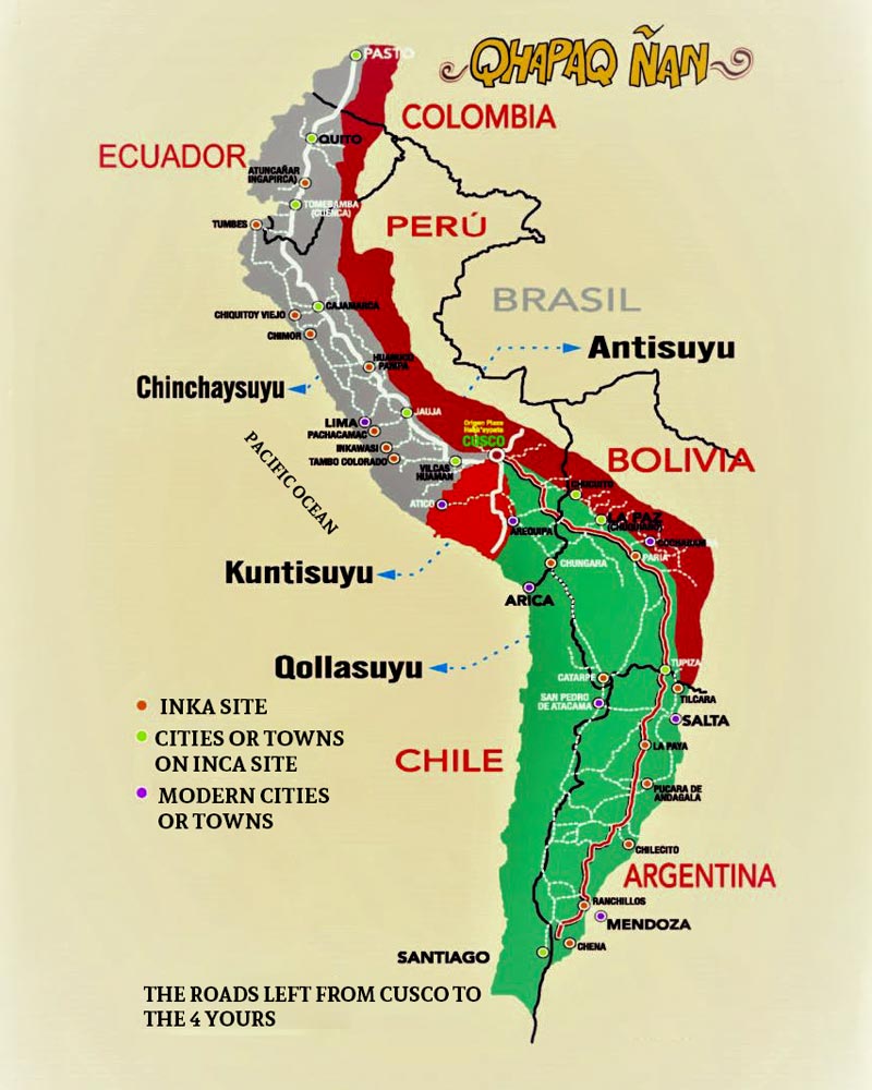
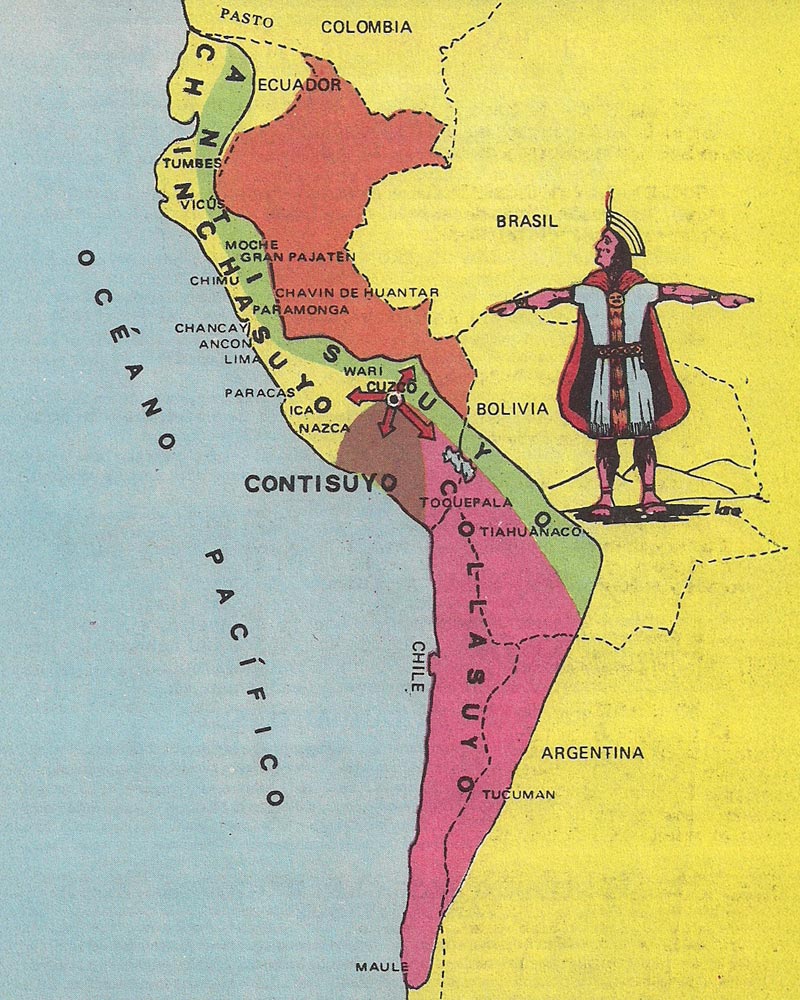
From Cusco’s Main Square, the center of power in the Inca Empire, the system branched into four great routes or suyus: Chinchaysuyu (north), Qollasuyu (south), Antisuyu (east), and Contisuyu (west). This division matched the political organization of the Tahuantinsuyo, ensuring that each region was connected to the capital.
The Qhapaq Ñan included coastal routes and high mountain routes, linked by secondary roads that reached agricultural zones, administrative centers, storage facilities (colcas), and rest stops (tambos). This combination of routes made it possible to travel through the Inca Empire location continuously, regardless of geography.
Adaptation to Extreme Ecosystems
The engineering of the Inca Empire stood out for its adaptability. On the coast, the Qhapaq Ñan was built with layers of compacted sand, while in the Andes, carved stones and drainage systems were used to withstand rain and snow.
The variety of climates and altitudes crossed meant that each section had a specific design. In this way, the Inca Empire achieved an Inca road system capable of functioning in deserts, snowy mountains, cloud forests, and tropical jungles.
Today, the Qhapaq Ñan is recognized as a unique testimony to pre-Hispanic territorial planning. It is considered not only an engineering feat but also a symbol of cultural integration and the living identity of the Tahuantinsuyo.
Did you know? Along the sections of the Qhapaq Ñan that crossed arid areas, the Incas built channels along the sides of the road, so travelers could access drinking water. They even planted fruit trees that provided shade and food in certain desert stretches. This demonstrates how integrated the road’s design was with the natural environment.
3. Who Built the Qhapaq Ñan?
The construction of the Qhapaq Ñan was a process that spanned several generations of rulers of the Inca Empire. Although many routes already existed before its expansion, it was the Inca Pachacútec who promoted a systematic plan to integrate and improve these Inca roads.
Pachacútec made use of pre-Inca roads built by cultures such as Wari and Tiwanaku, transforming them into safe and durable arteries that would connect all the regions of the Tahuantinsuyo.
The Work of Pachacútec’s Successors
After Pachacútec’s reign, it is believed that his son, Tupac Inca Yupanqui, continued extending the Qhapaq Ñan northward, reaching what is now Ecuador and part of Colombia. Later, Huayna Cápac is thought to have driven the expansion southward, integrating the territories of Chile and Argentina into the Inca Empire.
This road network served not only military purposes but also the administration of resources, the collection of tribute, and the rapid communication between regional capitals and Cusco, the heart of the Inca Empire.
The creation of the Qhapaq Ñan was made possible thanks to the mita, a system of mandatory, rotating labor that mobilized entire communities for state projects.
Workers, organized into groups, built specific sections using techniques adapted to each terrain. Every 20–30 kilometers, tambos (lodges or resting centers) and colcas (storehouses) were built for storing food and goods.
Engineering and Adaptability
The engineering of the Inca Empire allowed the road to withstand rain, snow, and earthquakes. Carved stones from the mountains, drainage systems, and retaining walls were used to prevent landslides.
In this way, the Qhapaq Ñan became an efficient and safe transportation network that united extreme geographies, strengthening both the control and the cultural cohesion of the Tahuantinsuyo.
4. Where Are the Qhapaq Ñan Roads Located and to Which Regions Do They Lead?
The Qhapaq Ñan was designed to unite the four regions, or suyus, of the Tahuantinsuyo, starting from the city of Cusco, capital of the Inca Empire. Each suyu connected unique landscapes—crossing mountains, valleys, deserts, and jungles—showcasing the impressive adaptability of Inca engineering.
The Four Directions of the Tahuantinsuyo
- Qollasuyu: Headed south, skirting Lake Titicaca and extending into what is now Bolivia and the north of Chile and Argentina. It was a strategic route for trading highland resources, including wool, dried meat, and salt.
- Contisuyu: Ran from Cusco toward the southern coast, connecting the present-day regions of Arequipa, Moquegua, and Tacna. It allowed the exchange of maritime and agricultural products.
- Antisuyu: Advanced eastward, penetrating the cloud forest and the Amazon. It served as an access route to resources such as coca leaves, tropical fruits, and fine woods.
- Chinchaysuyu: Extended northward, reaching Ecuador and Colombia, and integrating regions rich in cotton, maize, and dried fish.
Presence in Six South American Countries
Today, the Qhapaq Ñan has been identified in sections in Peru, Ecuador, Colombia, Bolivia, Chile, and Argentina. This makes it a shared cultural heritage among nations, officially recognized by UNESCO as a symbol of historical integration.
Not all the roads are in the same state of preservation. Some stretches remain intact, with their original stone paving, while others have been eroded, covered by vegetation, or replaced by modern highways.
5. Why Is the Qhapaq Ñan Important?
The importance of the Qhapaq Ñan lies in the fact that it was much more than a simple road system. It represented the backbone of the Inca Empire, articulating a vast territory and ensuring the political, military, economic, and cultural control of the Tahuantinsuyo.
This road system allowed the Inca Empire to maintain a centralized and efficient government, keeping constant communication between the capital, Cusco, and the most distant regions.
A Network for Cohesion and Control
The Qhapaq Ñan connected thousands of communities, enabling the transportation of essential goods such as food, textiles, and precious metals. It also facilitated the movement of armies to defend the territory and quell possible uprisings.
But its value was not only military or economic. It also served to integrate the Tahuantinsuyo culturally, spreading the Quechua language, the state religion, and official festivities. This exchange fostered a shared identity among people of very diverse origins.
A Living Heritage to This Day
Although it was built centuries ago, the Qhapaq Ñan is still used by rural communities in the Andes. Many of these routes are preserved thanks to their continued use, making this road system a true living heritage.
In some areas, the roads maintain their original function of connecting towns and markets, while in others, they have become tourist routes that allow modern travelers to experience the legacy of the Inca Empire.
Did you know? In the sections that crossed ravines and valleys, the Incas placed apachetas—small stone mounds—as signaling landmarks. These piles of stones marked the steepest points and served as guides for travelers in difficult terrain, long before the existence of modern routes.
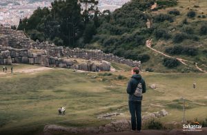
6. The Qhapaq Ñan Today
Today, the Qhapaq Ñan remains one of the most important cultural heritages of South America. Although time, urbanization, and erosion have affected parts of its structure, many of its original stretches remain intact, especially in the high Andean areas of Peru.
The best-preserved segments are found above 3,800 meters (12,467 feet) above sea level. There, the dry climate and stone construction have allowed the Inca road to survive almost as it was during the Inca Empire.
The Qhapaq Ñan Project and Its Preservation
The preservation of the Qhapaq Ñan is a joint effort among the six countries that share this legacy: Peru, Bolivia, Chile, Argentina, Ecuador, and Colombia. In Peru, the Qhapaq Ñan Project of the Ministry of Culture coordinates archaeological research, educational programs, and sustainable tourism plans.
This project focuses on four main areas: historical research, physical conservation, social use of the routes, and administrative management. Thanks to this work, the Inca Empire (also known as the Incan Empire) remains present in the lives of many communities that still use parts of the Inca road for daily transportation and economic activities.
A Tourist and Cultural Resource
In addition to its archaeological significance, the Qhapaq Ñan has become an international tourist attraction. Many stretches have been signposted and adapted for hiking, such as the famous Inca Trail to Machu Picchu, offering visitors a direct experience with the legacy of the Inca Empire.
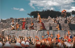
During local festivities, some segments are walked in processions and cultural events, keeping the tradition alive. These acts show that, beyond being a relic of the past, the Qhapaq Ñan continues to be a fundamental element of the cultural identity of the Inca Empire and the pride of Andean communities.
7. What Can I See on the Qhapaq Ñan?
Exploring the Qhapaq Ñan today means stepping into the living history of the Inca Empire. Along its thousands of kilometers, travelers can find everything from impressive archaeological remains to breathtaking natural landscapes.
This Inca road network is not just a collection of ancient stones, but a window into the social, economic, and spiritual organization of the Tahuantinsuyo. Each section offers a unique combination of Inca engineering and natural surroundings.
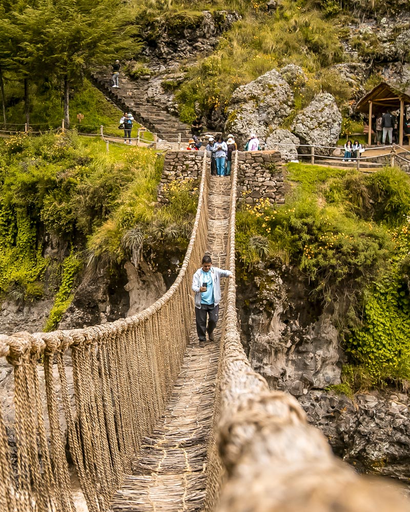
Q’eswachaka Bridge and Other Marvels
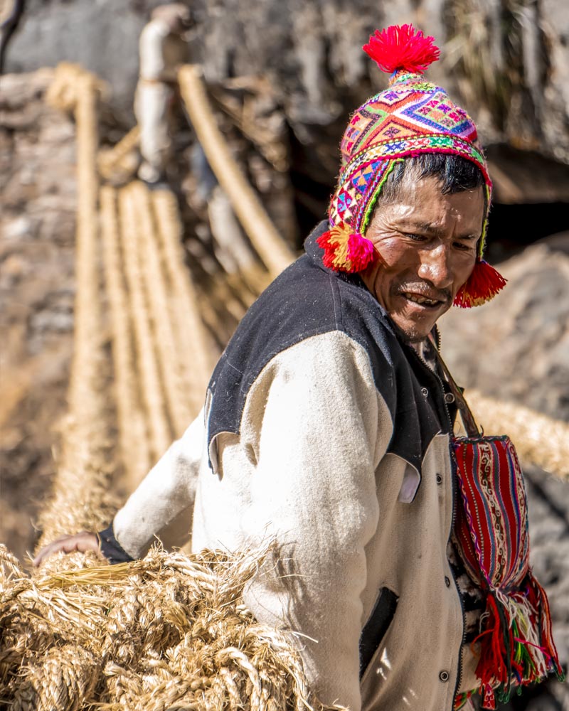
Another highlight is the Q’eswachaka Bridge, the last suspension bridge made of plant fibers still in use, rebuilt annually by local communities who keep the tradition alive. This bridge is a symbol of the collective spirit and ancestral knowledge of the Inca Empire.
Also notable is the Xauxa–Pachacamac section, which connects the central highlands with the Peruvian coast and passes by more than 120 archaeological sites. This route is a perfect example of how the Tahuantinsuyo integrated different ecological zones.
Ceremonial Centers and Secondary Routes
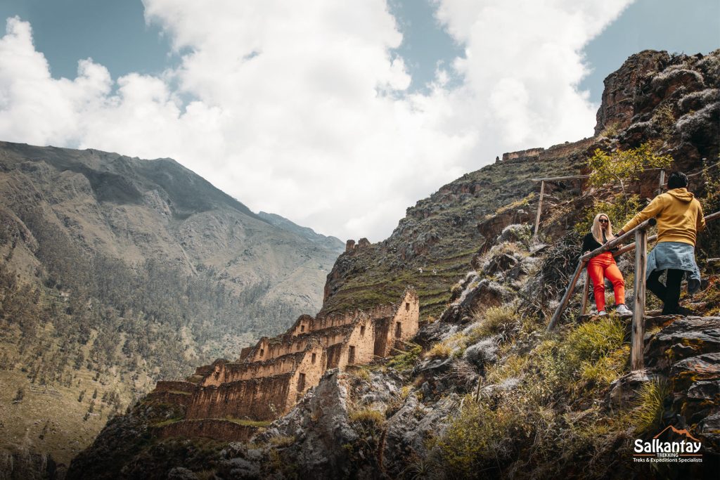
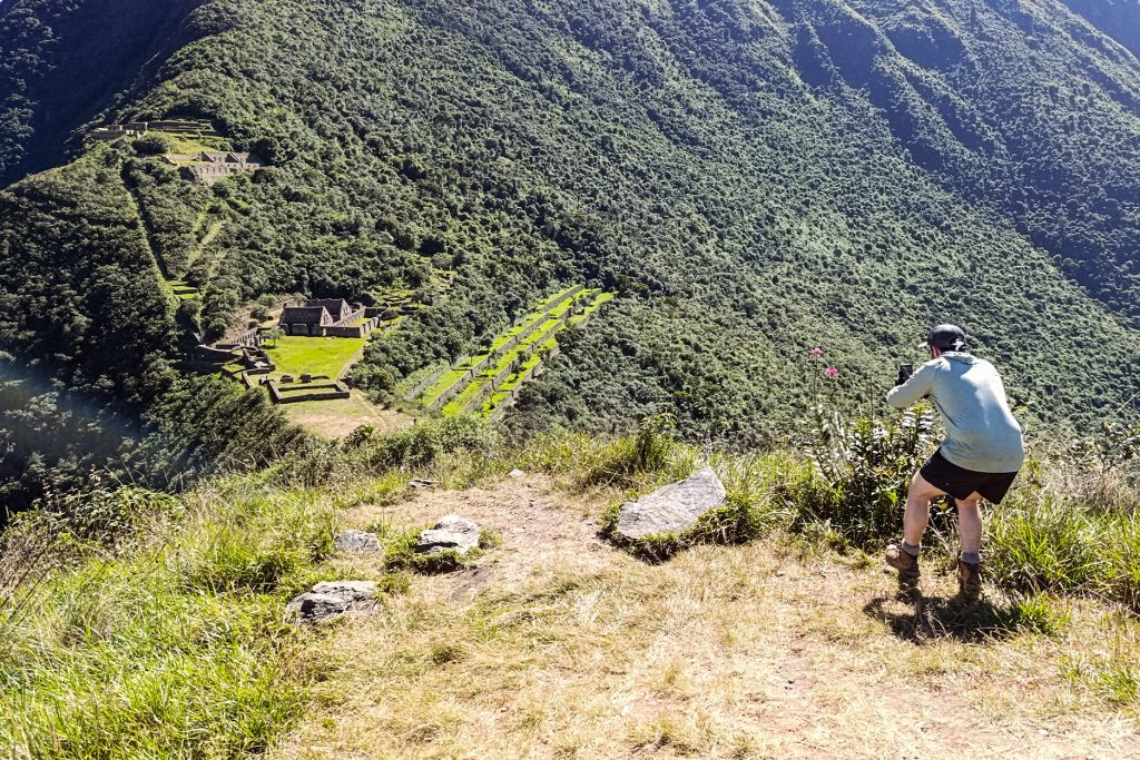
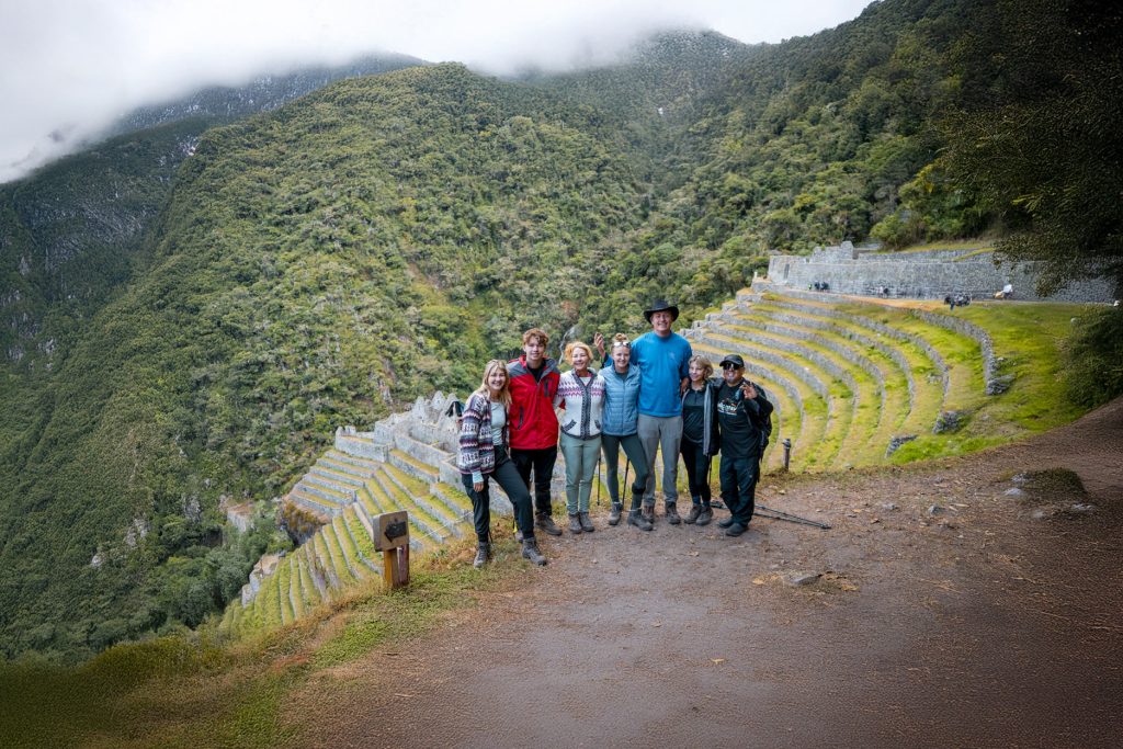
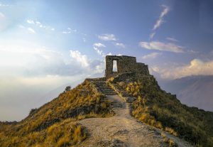
Beyond the main routes, travelers can visit sites such as Choquequirao and Vitkus, administrative and ceremonial centers connected to the Qhapaq Ñan. These places offer a quieter, less crowded experience than Machu Picchu but are equally enriching.
Each of these stretches allows visitors to experience the greatness of the Inca Empire firsthand, walking the same paths that once united cultures, economies, and beliefs under the organization of the Inca state.
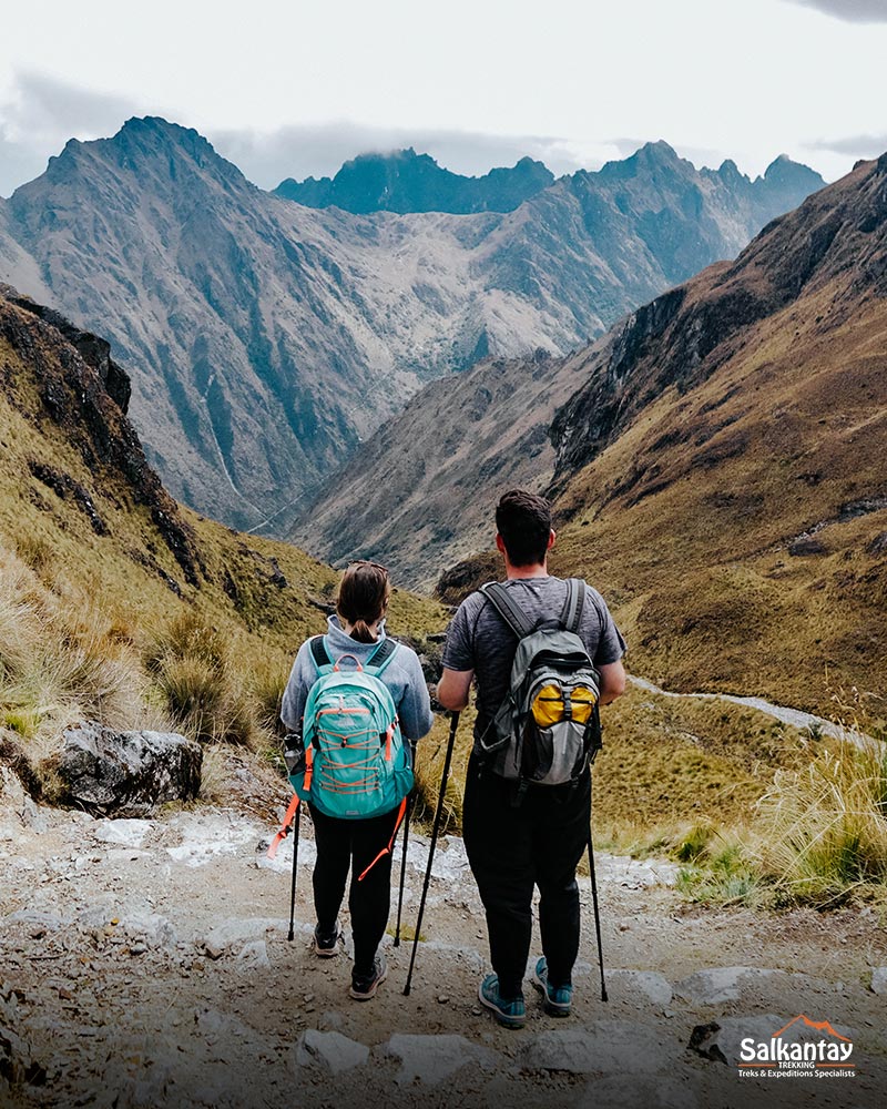
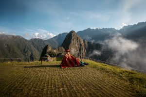
Inca Trail to Machu Picchu
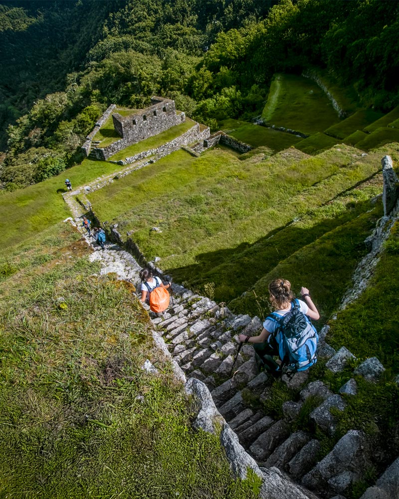
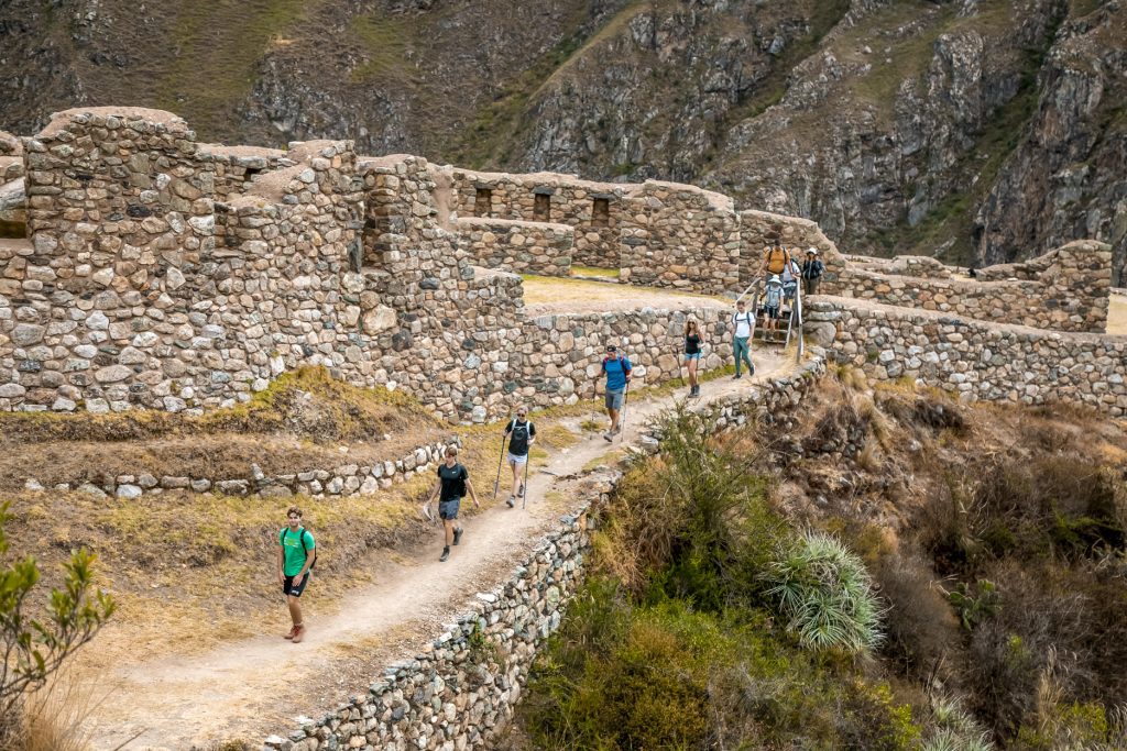
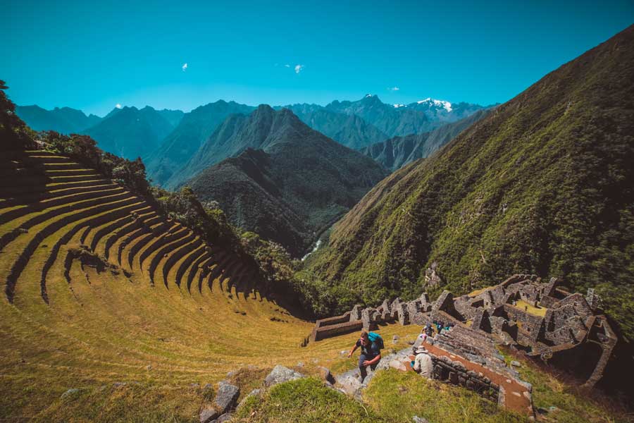
One of the most visited stretches of the Qhapaq Ñan is the famous Inca Trail to Machu Picchu. This path preserves stone stairways, drainage systems, and elevated sections that demonstrate the advanced engineering of the Inca Empire.
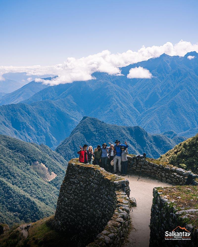
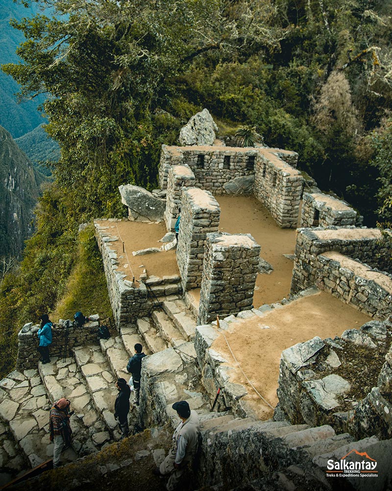
Along the route, travelers pass through archaeological sites such as Llactapata (urban and agricultural center, checkpoint), Sayacmarca (a complex of narrow streets, enclosures, and passages laid out on different levels), Runkurakay (an urban and religious center where the Incas controlled the movement of travelers), Phuyupatamarca (urban and religious site where crops such as maize were cultivated), and Wiñay Wayna (Inca citadel with religious and agricultural functions), before reaching the iconic Sun Gate (Inti Punku), the ceremonial entrance to Machu Picchu.
8. The Inca Trail to Machu Picchu
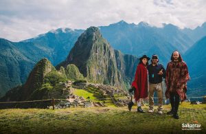
The Inca Trail to Machu Picchu is, without a doubt, the most emblematic stretch of the Qhapaq Ñan. This historic path was an essential part of the road network of the Inca Empire and is now recognized as one of the five most impressive hikes in the world.
Its fame comes from the perfect combination of landscapes, history, and culture. Walking it is a unique experience that reveals how the Tahuantinsuyo managed to connect its capital, Cusco, with one of its most important ceremonial centers: Machu Picchu.
A Journey Full of History and Nature
The classic route lasts 4 days and 3 nights, covering approximately 27 miles (43 kilometers). It begins at kilometer 82 of the Cusco–Machu Picchu railway and passes through diverse ecosystems, from fertile Andean valleys to high mountain passes.
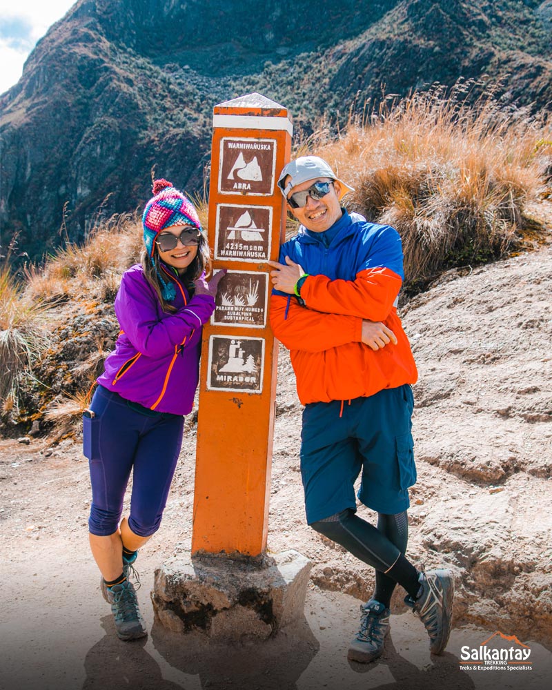
One of the most challenging points is Warmiwañusqa (4,215 m / 13,829 ft), known as “Dead Woman’s Pass.” From there, the trail descends into cloud forests, where the lush vegetation and biodiversity are stunning.
Archaeological Heritage Along the Trail
During the trek, hikers visit archaeological sites such as Llactapata, Runkurakay, Sayacmarca, Phuyupatamarca, and Wiñay Wayna. Each reflects the planning, engineering, and religious symbolism of the Inca Empire.
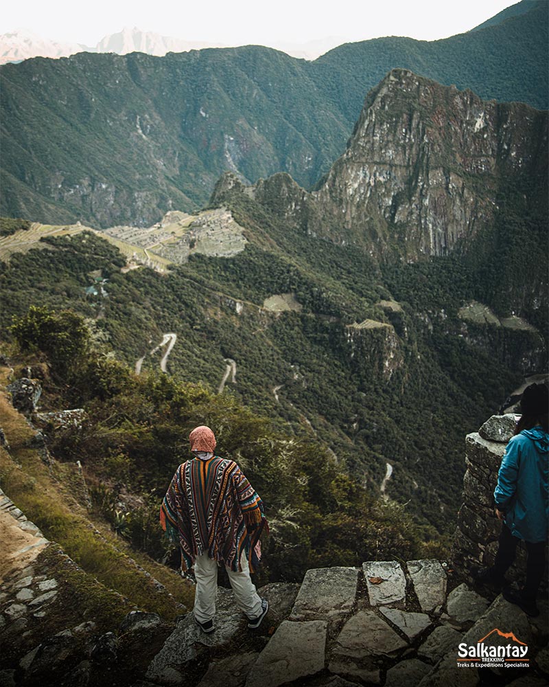
On the last day, the trail ends at Inti Punku (Sun Gate), the ceremonial entrance to Machu Picchu. Arriving there at dawn and watching the first rays of sunlight illuminate the citadel is a deeply spiritual experience for many travelers.
Regulation and Sustainability
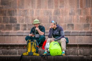
Due to its great historical value and the fragility of its structures, the Inca Trail to Machu Picchu is regulated by the Peruvian government. Only 500 people per day, including porters and guides, are permitted to enter, which means you must book your tickets in advance. This ensures the preservation of the Inca road and a safe experience for visitors.
Walking this stretch of the Qhapaq Ñan is not just a physical adventure, but also a cultural journey that connects visitors with the spirit of the Inca Empire and the grandeur of the Tahuantinsuyo.
The Inca Trail to Machu Picchu will take you along original sections of the Qhapaq Ñan, unveiling Andean landscapes and iconic archaeological sites. Book your guided trip today with Inca Trail – Salkantay Treks and be part of this unparalleled cultural experience.
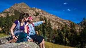
9. The Salkantay Trek to Machu Picchu
The Salkantay Trek to Machu Picchu is one of the most spectacular and less crowded alternatives to reach the famous Inca citadel. Although it is not a direct part of the classic Inca road network of the Qhapaq Ñan, it follows ancestral routes used by Andean communities since the time of the Incas.
This route is ideal for travelers seeking more contact with nature, greater flexibility, and a challenging physical adventure. In addition, it does not have the limited entry permits of the Classic Inca road (Inca Trail), allowing reservations with less advance notice.
A journey between sacred mountains and high jungle
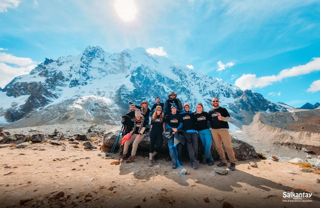
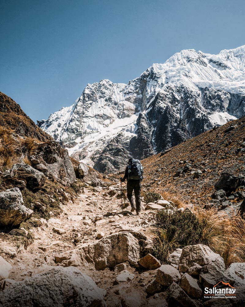
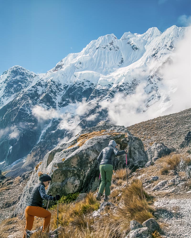
The central point of the route is the snow-capped Salkantay, which at 6,271 meters above sea level is one of the most imposing and sacred mountains of the Inca Empire location within the Tahuantinsuyo. In the Andean worldview, this apu or protective spirit was venerated by local communities and considered the guardian of the path to the edge of the jungle.
The classic itinerary lasts between 4 and 5 days, crossing diverse landscapes. It begins in high Andean areas with glacier views, passes through the Salkantay Pass (4,650 m a.s.l.), and descends toward the high jungle, where the climate becomes warmer, and the vegetation more abundant.
Living culture and local experiences
Along the route, travelers have the opportunity to interact with rural communities, visit coffee plantations, and learn about agricultural techniques inherited from the Inca Empire. These interactions add a cultural component that complements the natural experience.
Nights can be spent in ecological camps or rustic lodges, integrated into the landscape and designed to minimize environmental impact.
A different arrival at Machu Picchu
The final stretch of the Salkantay Trek leads to the Machu Picchu Hydroelectric Station, from where travelers continue on foot or by train to Aguas Calientes. This gradual arrival allows visitors to feel the excitement of approaching the jewel of the Incan Empire after days of hiking.
The Salkantay Trek to Machu Picchu is perfect for those who want a demanding route, with fewer tourists, combining wild nature, Andean culture, and the legacy of the Tahuantinsuyo.
Discover the magic of the Qhapaq Ñan and walk its most emblematic routes with local experts. Learn about the tours available on Salkantay Trekking and experience the heritage of the Inca Empire uniquely.
10. Frequently Asked Questions about the Qhapaq Ñan
Below are detailed answers to the most common questions about the Qhapaq Ñan, its history, its relevance in the Inca Empire, and its current importance as a living heritage of the Tahuantinsuyo.
- What is the Qhapaq Ñan?
The term Qhapaq Ñan comes from Quechua and translates as “Road of the Lord” or “Royal Road.” The name reflects its function as the main Inca road of the Inca Empire, used by nobility, officials, armies, and messengers. It was not just any road—it symbolized the power and organization of the Incan Empire. - Who promoted it?
Its consolidation is attributed to the Inca Pachacútec, considered the political and military architect of the Tahuantinsuyo. According to historical chronicles, Pachacútec expanded and improved pre-existing routes, creating a network that would be continued by Túpac Inca Yupanqui and Huayna Cápac. - How many kilometers did it have?
Estimates range between 30,000 and 40,000 kilometers. This included main and secondary routes that crossed the Andes, desert coasts, and jungle areas. - Where did it start from?
The heart of the Qhapaq Ñan was the Plaza Mayor of Cusco (Hawaypata), the political, religious, and administrative center of the Inca Empire location. From there, the roads extended in the four directions of the Inca location known as the suyus. - What were its main directions?
The suyus of the Tahuantinsuyo were:- Chinchaysuyu (north)
- Qollasuyu (south)
- Antisuyu (east)
- Contisuyu (west)
- What associated structures did it have?
Every 20–30 km, tambos (lodgings) and colcas (storehouses) were built. These infrastructures allowed rest, food storage, and facilitated logistics for the Inca Empire. - Where is it best preserved today?
In Peru, especially in areas above 3,800 meters above sea level, thanks to the dry climate and the durability of the stone used by the Incas. - What is the most visited route?
The Inca Trail to Machu Picchu, part of the Qhapaq Ñan, is the most popular for its natural beauty and archaeological sites. - What alternative route exists?
The Salkantay Trek is the best-known alternative. It does not have such limited permits and travels through equally spectacular landscapes, following ancestral routes of the Tahuantinsuyo. - Why does its importance remain today?
Because it is a living testimony of the Inca Empire, connecting past and present. Today, local communities use it for transportation and trade, while travelers from all over the world walk it to connect with the history and culture of the Andes.
You may be interested:
- Exploring the Unknown: Salkantay Premium Trek, 5 Days of Adventure
- Salkantay Trekking: The Best Tour Operator in Peru
- Trekking Routes in Cusco: Following the Wisdom of the Summits
- Salkantay Mountain: The Complete Guide.
- Salkantay Trek vs Inca Trail: Which is the Best Trek to Machu Picchu?
- Inca Trail Tickets: Everything You Need to Know
- What to Wear for The Inca Trail?
- Inca Trail: Essential Gear for an Unforgettable Adventure
- Inca Trail vs. Choquequirao Trail: Which Is the Best Option for Your Andes Adventure?


Leave A Reply