
Choquequirao is one of the most extraordinary and least-explored archaeological sites in South America. Often compared to Machu Picchu, it offers a completely different experience: wandering through a vast Inca city with few visitors, exploring each of its sections at your own pace, admiring its unique architecture, and tackling a challenging trek surrounded by some of the most spectacular landscapes in the Andes.
In this guide, you’ll discover everything you need to know to understand why Choquequirao deserves a spot on your next trip and how to plan your adventure from the very first step.
Table of contents
- Why Visit Choquequirao?
- What is Choquequirao?
- History
- Architecture
- What can you see at Choquequirao?
- Where is Choquequirao?
- Difficulty Level
- The Altitude of Choquequirao
- The Best Time to Visit Choquequirao
- Choquequirao Admission Tickets
- The Choquequirao Ecosystem
- Rules for Visiting Choquequirao
- What to Bring on the Choquequirao Trek?
- Tips for the Hike to Choquequirao
- Frequently Asked Questions
- Choquequirao: an adventure worth every step
Why Visit Choquequirao?
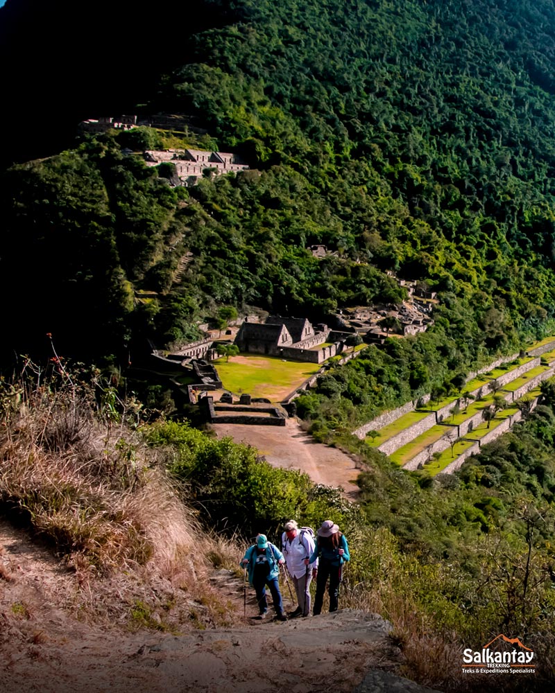
The Choquequirao archaeological site is an ancient Inca city that offers an experience very different from that of other archaeological destinations in Peru. Upon arrival, you won’t find long lines or crowds. You’ll be able to explore every temple, plaza, terrace, and viewpoint at your own pace, without set routes limiting your journey, enjoying the feeling of having this extraordinary place almost all to yourself.
Discover architecture unique to the Inca world
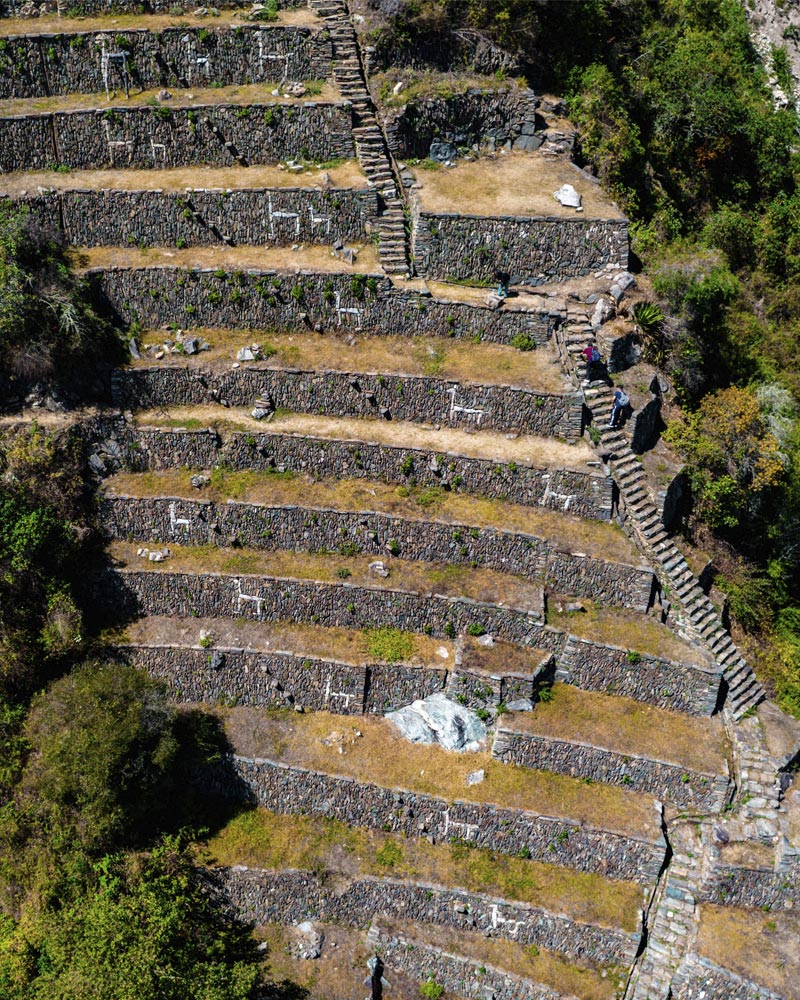
One of its greatest attractions is the famous “Llamas of the Sun” terraces at Choquequirao, a series of llama figures crafted from white quartz stones embedded in the agricultural terraces.
This is a unique architectural feature within the Inca world that has not been found at any other known archaeological site. Its origin and purpose remain the subject of study, making it one of Choquequirao’s greatest mysteries.
Experience the thrill of discovering a place few people know about
Known as Machu Picchu’s sister due to the majesty of its architecture and its historical significance, Choquequirao retains a much more authentic and tranquil atmosphere. It can only be reached via a multi-day trek, a factor that has kept large crowds at bay.
For many travelers, that challenge is part of the experience: walking among imposing mountains, traversing diverse ecosystems, and discovering, step by step, an Inca city that still conveys the thrill of feeling as though it has just been rediscovered.
What is Choquequirao?
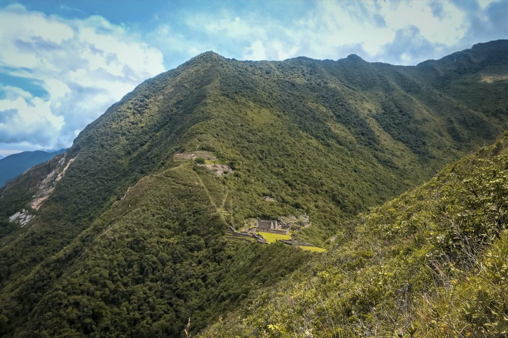
Choquequirao is an ancient Inca city located in the mountains surrounding the Apurímac Canyon, in the Cusco region. Covering more than 1,800 hectares, it is one of the largest archaeological complexes built by the Incas. However, to date only about 30% has been excavated, so much of the city remains hidden among the vegetation.
Within the complex, you’ll find much more than just agricultural terraces. You can explore plazas, temples, ceremonial sites, water channels, and platforms built with the impressive engineering that characterized the Inca Empire.
Although archaeologists are still investigating its history, the most widely accepted theory suggests that Choquequirao served administrative, ceremonial, and agricultural functions within the Vilcabamba Valley. Its extensive terraces, built into the steep mountain slopes, demonstrate the importance this site held for the Incas.
What does Choquequirao mean?
Choquequirao is a Quechua word that translates to “Golden Cradle” or “Cradle of Gold.” It is derived from the Quechua words chuqui (gold) and k’iraw (cradle).
It is not known for certain why it was given this name. One of the most widely accepted theories suggests that it is due to the brilliance reflected by the stones (limestone and granite) used to build the complex when they catch the sunlight. Another theory holds that the name refers to the importance and wealth this place held during the Inca era.
History
Before the Incas
Long before the Incas built Choquequirao, various peoples were already living in this area. Among them were the Antis, Manatíes, and Pilcozones.
In addition, archaeologists have found pottery from the Killke culture, demonstrating that these mountains were already inhabited between 1000 and 1200 AD. However, it is still not known exactly how they used this territory.
Inca Period
During Pachacútec’s reign, the Inca Empire began to expand toward the Vilcabamba mountain range. It was then that construction of Choquequirao began. Thanks to its enormous terraces, water channels, and stone buildings, the city became an important center that served administrative, agricultural, and ceremonial functions.
From here, access to the jungle was controlled; from there came highly valuable goods, such as coca, exotic feathers, and other resources used in ceremonies and offerings dedicated to the Sapa Inca and the Andean gods.
Years later, Túpac Inca Yupanqui ordered the expansion of several of its structures, giving rise to the impressive complex we can visit today.
A Refuge During the Spanish Conquest
When the Spanish conquered the Inca Empire, many areas were destroyed or abandoned. Thanks to its difficult access, Choquequirao remained protected among the mountains.
For this reason, many historians believe that between 1537 and 1572, the Inca rebels (Manco Inca, Sayri Túpac, Titu Cusi Yupanqui, and Túpac Amaru I) maintained their resistance for several decades in Vilcabamba before the empire’s final collapse, with Choquequirao serving as a particular refuge and frontier.
The end of the rebellion with the death of Túpac Amaru in 1572 led to the exile and persecution of the families of the former Inca elite; many of them sought refuge in unknown territories, fleeing from Martin Hurtado de Arbieto
A City Hidden for Centuries
After the Spanish conquest, Choquequirao was covered by dense Andean vegetation and remained virtually hidden for centuries. Although local communities knew of the existence of these ancient structures, it wasn’t until 1768 that references to this ancient settlement began to spread. The news reached the naturalist and historian Francisco Cosme Bueno, who brought greater attention to the site and sparked the interest of travelers and adventurers.
Driven by curiosity, many ventured to cross the mighty Apurímac River and traverse an extremely challenging trail to reach the citadel. There they found impressive stone structures and evidence of metalworking, confirming the importance of this ancient settlement.
A document preserved in the Cusco Regional Archive, part of a 1786 file, mentions a place associated with the “City or Town of Silversmithing.” These records include correspondence between colonial authorities, references to mines, and descriptions of a very difficult route. Even back then, accounts already emphasized that the path to Choquequirao posed a real challenge just as it continues to do today.
The Rediscovery of Choquequirao
During the 19th and 20th centuries, visits by travelers, explorers, and researchers became increasingly frequent. One of the first to document his visit was the French marquis Eugène de Sartiges, who visited the site in 1834. Decades later, in 1909, Hiram Bingham arrived while searching for the legendary lost city of Vilcabamba. Although Choquequirao was not the destination he had hoped to find, he conducted the first topographic survey of the area and drew up a map that would prove invaluable for future research.
In 1986, the first cleanup and restoration work on the monument began. Later, in 2003, Choquequirao was officially declared a National Cultural Heritage Site, a designation that spurred new research, conservation, and enhancement projects. Since then, initiatives have been launched to protect the archaeological site, improve access, and strengthen its development as one of Peru’s most extraordinary archaeological destinations.
Architecture
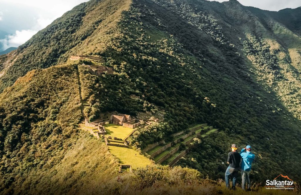
Building Choquequirao amid such steep mountains was a major challenge. The Incas had to adapt the city to the terrain and create terraces, stairways, walls, and canals in order to live there, grow food, and channel water through different areas.
Unlike other Inca sites, where large, perfectly polished stones are a prominent feature, at Choquequirao you’ll mainly find walls built with hewn stone held together with clay mortar. Its architecture demonstrates how the Incas took advantage of the mountains’ natural contours rather than trying to completely alter them.
What can you see at Choquequirao?
Choquequirao is divided into nine sectors, including plazas, temples, dwellings, storage areas, ceremonial spaces, and large terraced complexes that served agricultural, religious, and administrative functions. Learning what each one was used for will help you understand what you’re seeing as you explore the complex.
Main Plaza
The Main Plaza occupies a central area of the complex and is surrounded by some of its most important buildings.
The Incas used the plazas as gathering places and for public and ceremonial activities. That’s why this is a good place to start understanding how the city was organized.
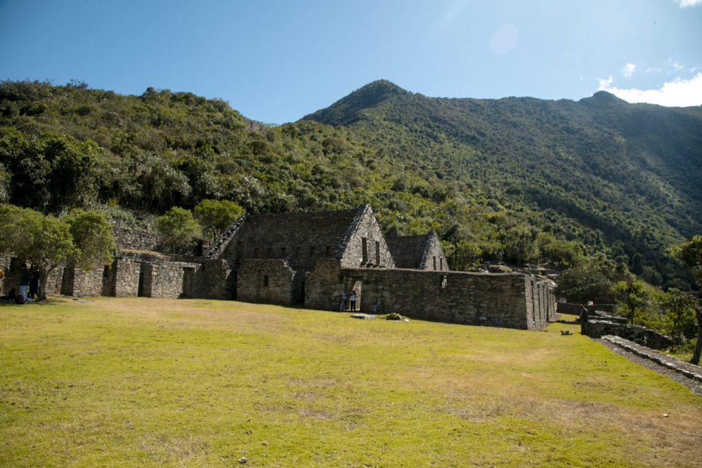
Hanan Temple
The Hanan Temple is located north of the Main Plaza, in subsector B. During your visit, you’ll see several rectangular corridors and platforms, as well as double-jamb niches in its walls.
Ushnu
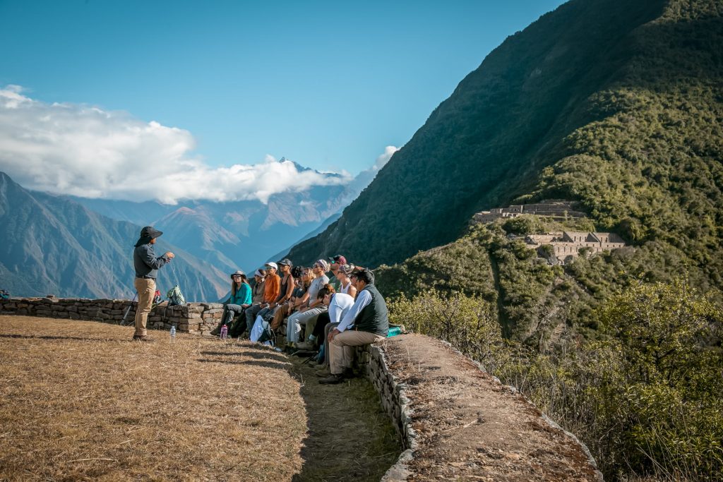
The Ushnu is located on a hill south of the Main Plaza. It was a ceremonial site associated with rituals and offerings of thanks to Pachamama.
Its elevated location is no coincidence either. From here, you can overlook much of the landscape surrounding Choquequirao, and it currently serves as one of the best viewpoints in the complex.
Qolqas
The qolqas were storage facilities. The Incas used these types of buildings to store food and other products necessary to sustain the population and manage their resources.
At Choquequirao, you can identify nine platforms and five rectangular structures associated with this function.
Las Portadas
South of the Main Plaza, you’ll find Las Portadas, a site notable for its four double-jambed niches an architectural feature that the Incas reserved for buildings of special importance.
This site was associated with ceremonial and religious activities. Its location near the plaza also indicates that it was part of one of Choquequirao’s most important sectors.
Kallankas
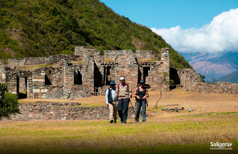
The kallankas were large rectangular buildings that could be used for meetings, workshops, and various administrative or communal activities.
Their size allowed for gathering large numbers of people under one roof, making them significant structures that are easily distinguished from smaller domestic buildings. The two kallankas at Choquequirao feature water channels.
Priest’s House
To the southwest of the Ushnu, you’ll find two rectangular buildings known as the Priest’s House. Because of their location near the ceremonial area, they are associated with the people who participated in religious activities.
Currently, some areas may remain off-limits while archaeological and conservation work continues.
Pikiwasi
Pikiwasi is located southeast of the Main Plaza and comprises 16 buildings of various sizes.
Unlike the large ceremonial spaces, this area offers a glimpse into daily life in Choquequirao. Its structures are associated with housing and various work activities.
Irrigation System and Canals
The Incas also designed a network of canals and irrigation ditches to carry water to different parts of Choquequirao. These canals supplied agricultural areas and other parts of the complex.
You can still see parts of this system as you explore the site, especially in Sector VIII, which is associated with the terraces and ceremonial spaces.
Phaqchayoq and the House of Water
Phaqchayoq is one of Choquequirao’s major agricultural sectors. Its terraces cover approximately 5.7 hectares and demonstrate the extent to which the Incas adapted the slopes for cultivation.
In this area, you’ll also find the so-called House of Water, a space associated with water management and possibly with ceremonial activities related to this resource.
Inca Cemetery
Also known as the Triumphal Wall, archaeological research in this area uncovered 17 burial bundles, as well as a water channel.
These findings shed light on another aspect of Choquequirao: not only how its inhabitants lived, but also the spaces associated with death and their funerary practices.
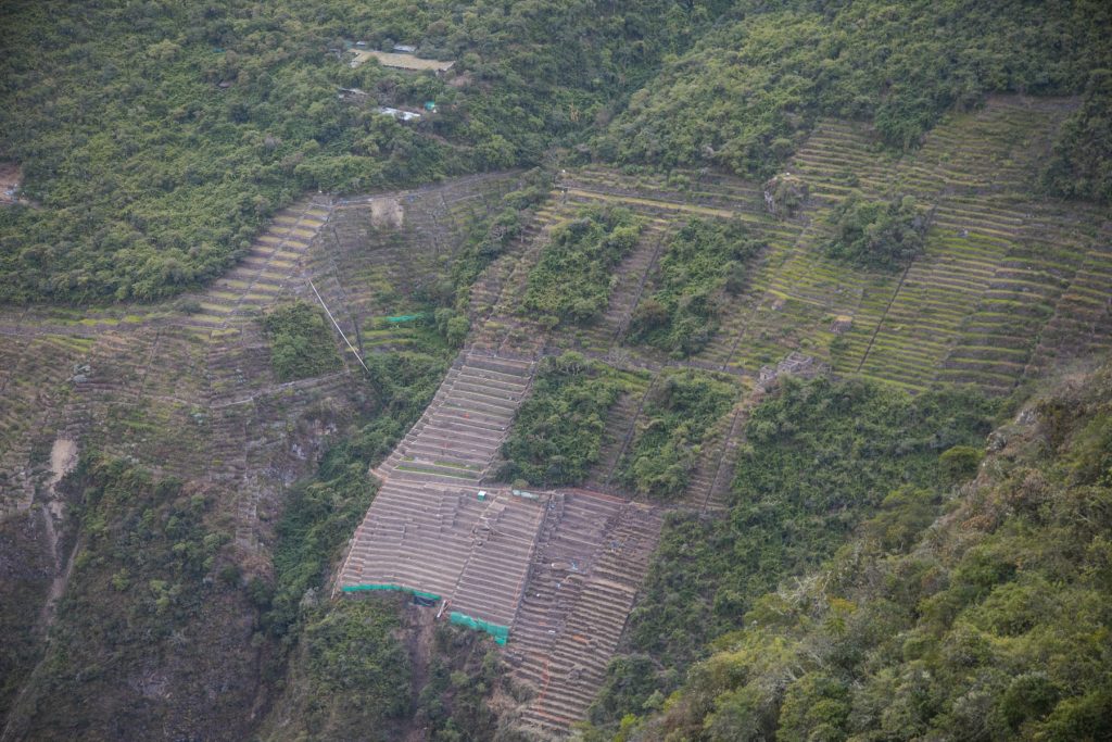
The Terraces of Choquequirao
The terraces, or andenes, are one of the most impressive features of Choquequirao. Some stretch 600 de metros up the slopes and are connected by long stairways.
The terraces helped conserve moisture, control erosion, and take advantage of varying light and temperature conditions. Additionally, the terraces could create different growing conditions depending on their elevation and location. But not all terraces served the same agricultural purpose.
The Llama Terraces
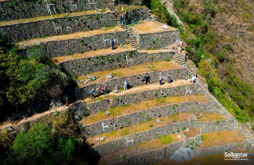
This is one of Choquequirao’s greatest treasures, also known as the “llamas of the sun.”
To the northeast of the main plaza, at the base of one of the slopes, you’ll find a series of terraces decorated with figures created using light-colored stones set into the walls. Among them are llamas, human figures, and geometric designs.
These representations are particularly important because they form a rare artistic ensemble within Inca architecture and continue to be studied to better understand their meaning; for now, it is believed that they are linked to the Inca religion.
Paraqtepata
Paraqtepata consists of 18 terraces, as well as other groups of terraces and canals used to carry water to the crops.
Its location on a rugged hillside once again demonstrates how the Incas transformed steep terrain into usable spaces.
Pinchaunuyoq
Pinchaunuyoq is located farther from the main center of Choquequirao, in the direction of Cotakoka. Here you’ll also find agricultural terraces and other structures scattered across the mountainside.
Reaching it requires an additional hike, so not all visitors include this area in their tour.
Choquequirao still has much to reveal. That’s why, as you walk through the complex, you’re not just exploring an ancient Inca city you’re visiting an archaeological site where questions still remain to be answered.
Where is Choquequirao?
Choquequirao is located in the district of Santa Teresa and Vilcabamba, in the province of La Convención, Cusco, at an elevation of about 3,033 m / 9,951 ft. It rises above the mountains surrounding the Apurímac River canyon, very close to the border between Cusco and Apurímac.
Its location is part of what makes the experience so special. Choquequirao remains hidden among the mountains, far from roads and large cities. To find it, you’ll have to venture deep into the Andes and hike to reach its ruins.
How do you get to Choquequirao?
Getting to Choquequirao is part of the adventure. There is no road, train, or cable car that will take you directly to the archaeological site, so you’ll have to hike to find this city hidden among the mountains.
The good news is that there isn’t just one way to do it. There are different routes and access points, from the classic route via Cachora to alternatives via Huanipaca or Yanama. Your choice will depend mainly on how many days you have available and the kind of adventure you want to experience.
| Route or Access | Approx. Duration | Approx. Distance | What to Expect |
|---|---|---|---|
| Cachora – Choquequirao | 4-5 days | 55 km | The classic option and one of the most popular ways to visit Choquequirao. |
| Huanipaca – Choquequirao | 4 days | 64 km | An alternative route from Apurímac for those looking for a different experience. |
| Yanama – Choquequirao | 2-3 days | 13 km | An option for those with limited time who want to visit Choquequirao. |
| Mollepata – Choquequirao | 5 days | 135 km | Although it’s the longest route, it crosses the Salkantay Pass toward Santa Teresa and offers a variety of landscapes. |
Choquequirao with Salkantay Trekking
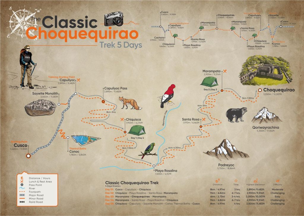
Reaching Choquequirao will be challenging, but you don’t have to worry about organizing every detail. On our 5-day Classic Trek to Choquequirao, you can focus on the journey while our team takes care of the logistics.
During the adventure, you’ll traverse the Apurímac Canyon, hike through mountains and small communities, and rest each night knowing that your campsite and a hot meal will be waiting for you. Our team also handles transporting the necessary gear and accompanies you throughout the trek.
But the real reward comes at Choquequirao. We set aside plenty of time so you can explore it at your own pace, wander through its plazas, temples, and terraces, descend to the famous Llamas del Sol, and learn from your guide what made each section special.
The effort to get there will still be up to you. We make it possible for you to focus your energy on what really matters: walking, exploring, and enjoying Choquequirao.

Difficulty Level
Now that you know more about Peru’s undiscovered gem, you’re probably wondering: How difficult is the hike to Choquequirao?
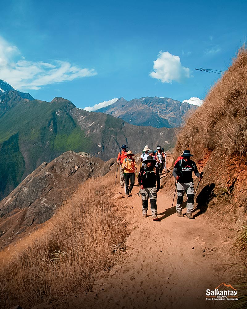
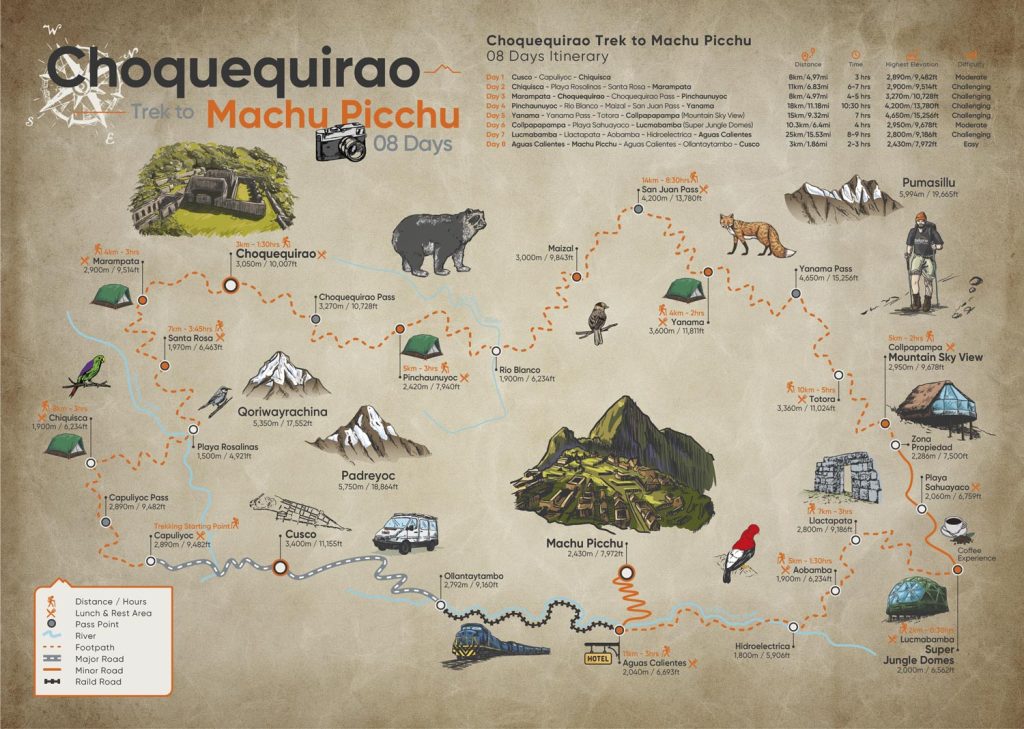
The difficulty varies depending on the route you choose, but in general, the Choquequirao Trek ranges from moderate to challenging. On the traditional routes, the highest elevation is around 3,050 m / 10,007 ft, so the biggest challenge is usually not the altitude, but rather the distance, the terrain, and the steep inclines along the trail.
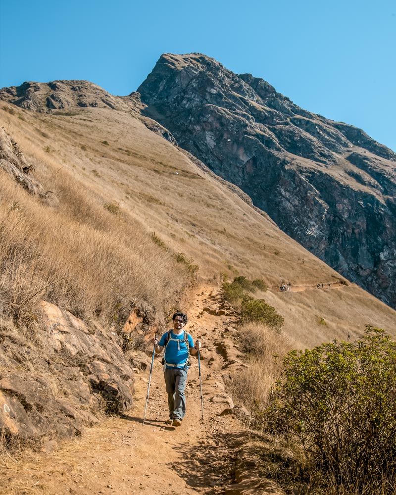
The trail winds through the Apurímac Canyon with long descents and steep ascents, as well as rocky terrain and unpaved sections. Your legs will really feel the strain when you have to climb back up everything you previously descended.
Duration also plays a role. Traditional routes usually take between 4 and 5 days, and choosing a shorter itinerary may mean walking more hours each day. The weather can also increase the difficulty: heat during descents, rain, or a wet trail can slow your progress.
| Factor | What You Need to Know |
|---|---|
| Overall Difficulty | Moderate to challenging |
| Maximum Elevation | Approx. 3,050 m / 10,007 ft on traditional routes |
| Typical Duration | 4-5 days |
| Main Challenge | Steep elevation changes and multi-hour hiking days |
| Terrain | Mountain trails, slopes, and rocky sections |
| Hiking Hours | Vary by route; fewer days usually mean longer hiking days, such as 7 hours |
| Weather | Heat, rain, and humidity can make things more difficult |
Travel Tip: The Choquequirao Trek passes through remote areas, and you won’t find any stores or services along the entire route. Bring everything you’ll need for each day, or make sure your trek package includes the supplies you’ll need along the way.
The Altitude of Choquequirao
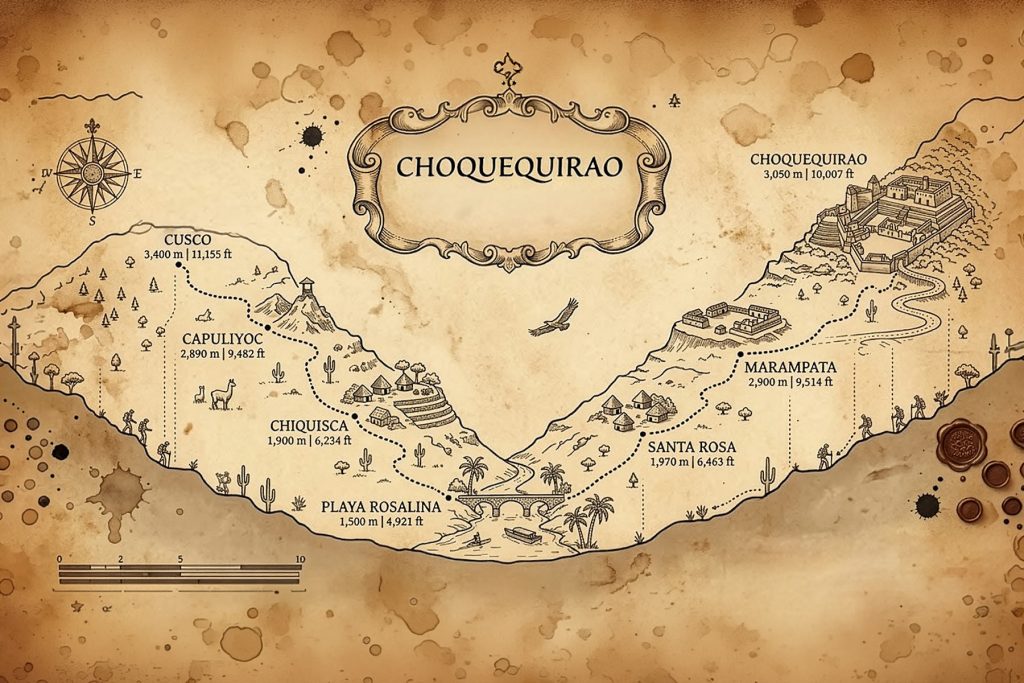
As you’ve probably noticed, altitude isn’t the biggest challenge on the Choquequirao Trek. On the traditional routes, the highest point is the Choquequirao archaeological site itself, at 3,050 m / 10,007 ft even lower than the city of Cusco, which sits at about 3,400 m / 11,155 ft.
What you’ll really feel along the way are the changes in elevation. The trail descends to the bottom of the Apurímac Canyon and then climbs again between Santa Rosa and Marampata until it reaches Choquequirao. It is precisely this contrast between steep descents and ascents that makes the trek so demanding.
| Location | Elevation |
|---|---|
| Cusco | 3,400 m / 11,155 ft |
| Capuliyoc | 2,890 m / 9,482 ft |
| Chiquisca | 1,900 m / 6,234 ft |
| Playa Rosalina | 1,500 m / 4,921 ft |
| Santa Rosa | 1,970 m / 6,463 ft |
| Marampata | 2,900 m / 9,514 ft |
| Choquequirao | 3,050 m / 10,007 ft |
| Saywite Monolith | 3,500 m / 11,483 ft |
| Conoc Hot Springs | 1,780 m / 5,840 ft |
Altitude Sickness in Choquequirao
Can you get altitude sickness in Choquequirao? Yes, it’s possible. Although Choquequirao doesn’t reach the high altitudes of other treks in Cusco, someone coming from sea level may feel the effects of being above 3,000 meters (9,843 ft).
That’s why we recommend spending at least one or two days in Cusco before starting the trek. This will help your body gradually acclimate to the altitude.
The Best Time to Visit Choquequirao
The best time to visit Choquequirao is usually during the dry season, between May and September. During these months, you’ll experience less rain, more clear days, and better conditions for hiking the mountain trails.
However, Choquequirao’s weather can be unpredictable. Although it’s located in Cusco, not the entire trek is cold. The route descends into the Apurímac Canyon, where the elevation is lower and days can feel quite warm. As you climb back up toward Marampata and Choquequirao, temperatures change and nights become cooler.
That’s why, during a single hike, you can go from the heat of the canyon to much cooler mornings and nights at higher elevations.
Dry season: May through September
If you’re looking for the best conditions for trekking, these are the months we recommend.
Rain is less frequent, and you’ll have a better chance of clear skies. This also helps keep the trails drier, which is important on a route with steep slopes and elevation changes.
Days can be sunny and warm, especially in the lower parts of the canyon, while mornings and nights will be cooler as you gain elevation.
Rainy season: November through March
Between November and March, rainfall increases in this part of the Andes. The landscape becomes much greener, but the trek can also be more unpredictable.
Rain can make some sections damp or slippery, and during periods of heavy rainfall, it can increase the risk of landslides or temporarily affect access routes.
This doesn’t mean it rains all day or that Choquequirao automatically closes for the entire season. Conditions can change from one day to the next, so it’s important to check the trail conditions before traveling.
Transition Months
These months mark the transition between the two seasons and can be a good alternative.
April may still see some rain, but you’ll find lush green landscapes after the rainy season. October, on the other hand, usually marks the gradual return of the rains.
If you have flexibility and want to travel outside the peak months, these dates are worth considering.
Choquequirao Admission Tickets
Unlike Machu Picchu, visiting Choquequirao does not require booking a ticket several months in advance. You can purchase your ticket in person at the start of the trail in Capuliyoc/Cachora or at the checkpoint before entering the archaeological complex.
Bring your ID or passport and cash in Peruvian soles to make the payment.
How much does it cost to enter Choquequirao?
The official rates are:
- General admission: S/ 60
- College students: S/ 30
- Minors: S/ 25
Peruvian visitors over the age of 60, people with disabilities, teachers, and those performing voluntary military service are eligible for a 50% discount on the admission fee. To claim this discount, they must present documentation proving their eligibility.
Source: Cusco Regional Directorate of Culture
Choquequirao Visiting Hours
The official visiting hours for the Choquequirao Archaeological Park are from 7:00 a.m. to 4:00 p.m.
Choquequirao does not follow the tour routes or admission schedules established for Machu Picchu. However, you must adhere to the visiting hours and regulations set by the Ministry of Culture. Source: Ministry of Culture.
The Choquequirao Ecosystem
Choquequirao is not only notable for its archaeology. The trek also allows you to discover one of the most diverse natural environments in this region, featuring 10 ecosystems.
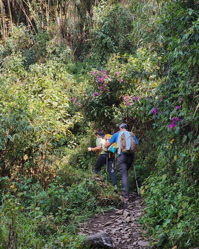
During the hike, you’ll experience marked changes in elevation and landscape. The traditional route descends from the mountains into the deep Apurímac Canyon, crosses the river, and climbs back up to the montane forests surrounding Choquequirao.
These changes create very different habitats along the route and explain the area’s great diversity of flora and fauna.
Fauna of Choquequirao
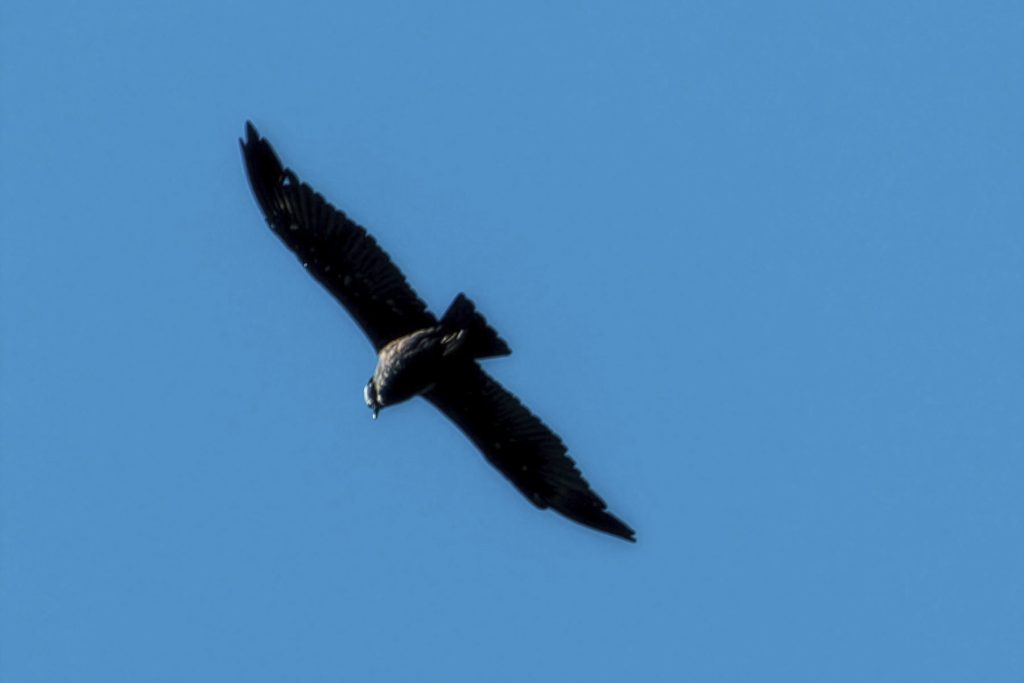
One of the great rewards of the trek is observing wildlife in its natural habitat. Some species associated with this environment include:
- Andean condor
- Spectacled bear
- Puma
- Andean fox
- Vizcacha
- White-tailed deer
- Ocelot
- River otter
- Cock-of-the-rock
- Canyon duck
- Hummingbirds
- Eagles, owls, and kestrels
- Butterflies, amphibians, and various species of insects
This doesn’t mean you’ll see all these animals during a hike. Many species are elusive, and spotting them depends on the season, the location, and, of course, a little luck.
Flora of Choquequirao
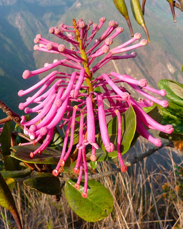
The vegetation also changes as you make your way through the canyon and gain elevation. In different areas, you can find trees, shrubs, medicinal plants, ferns, and flowers native to Peru’s high jungle and montane forests.
Among the most representative species are:
- Cedar
- Walnut
- Chachacomo
- Muña
- Aguaymanto
- Chilca
- Ferns
- Sullu sullu
- Andean daisy
- Orchids
Choquequirao is home to an extraordinary diversity of orchids. According to official records, 196 species have been identified in this area. Among the most striking and easily found along the trail are: Wiñay Wayna, Waqanki, and Zapatito de la Reina.
Orchids are particularly interesting due to the variety that thrives in the region’s humid environments.
Tip: Enjoy the plants and flowers in their natural setting. Do not cut them or remove them from the trail.

Rules for Visiting Choquequirao
Choquequirao is a protected archaeological site. During your visit, you must follow the established guidelines to preserve both the Inca structures and their natural surroundings.
Inside the archaeological complex:
- Please observe the official visiting hours.
- Climbing on, painting, or damaging the archaeological walls is prohibited.
- Animals are not permitted within the site.
- Drone flights require prior authorization from the Cusco Decentralized Directorate of Culture (DDC Cusco).
- Alcoholic beverages and prohibited substances are not allowed inside the site.
- Camping within the archaeological site is prohibited.
These rules correspond to the official regulations of the Cusco Decentralized Directorate of Culture.
What to Bring on the Choquequirao Trek?
If you plan to hike Choquequirao in Peru, it’s important to bring the following items to ensure a safe and comfortable experience:
- Original passport or original ID
- Backpack
- Comfortable hiking boots
- Sleeping bag
- Flashlight
- Sunscreen
- Jungle mosquito repellent (most important)
- Trekking poles
- Personal medications
- Rain poncho
- Lightweight, comfortable, and warm clothing
- Hat or cap
- Camera
- Spare batteries and portable charger
- Sunglasses
- Water and snacks
- Medications
- Flashlight or headlamp
- Cash in soles
Tips for the Hike to Choquequirao
Here are some tips to help you enjoy your hike to Choquequirao to the fullest:
Get in shape
Go for hikes, do cardio exercises, and strengthen your legs before the trip. The difficulty of the Choquequirao hike isn’t just about the distance—the steep, cumulative ascents and descents are one of its biggest challenges.
Acclimatize Before You Start
Spend at least two days in Cusco before the trek. Although Choquequirao doesn’t reach the extreme altitudes of other trails in the region, proper acclimatization will help you better handle the daily hikes.
Choose the right season
The dry season, roughly from May to September, generally offers better hiking conditions. Between December and March, rainfall increases, and there may also be a higher risk of landslides or trail closures in some areas.
Start early
Starting your hikes in the morning allows you to take advantage of the cooler hours and avoid some of the intense heat that can be felt in the lower parts of the Apurímac Canyon.
Bring Cash
Don’t rely on credit cards, ATMs, or digital payments during the hike. Bring enough soles to cover additional expenses and any services you may need along the way.
Hike with a Guide
Although it’s possible to find information about the route on your own, a guide provides safety, direction, and historical and natural insights during the hike.
Take Care of Choquequirao
Carry out all your trash and respect both the archaeological sites and the natural environment. Do not remove stones, plants, or other items from the trail.
Choquequirao has stood for centuries among the mountains of Vilcabamba. Visiting it also means taking on the responsibility of preserving its terraces, trails, forests, and wildlife for those who come after you.
And if you have more time, you can also take the adventure even further. There’s a trail that connects Choquequirao with Machu Picchu ideal if you don’t want to choose between these two great Inca cities.
Frequently Asked Questions
It’s not the most recommended trek for beginners, but you don’t need to be an experienced mountaineer either. With good physical fitness, some prior training, and a steady pace, you can complete the trek even if it’s your first major trek.
It depends on the kind of adventure you’re looking for. Choquequirao offers a more remote and challenging experience, while the Salkantay Trek combines high-mountain scenery with a route that ends at Machu Picchu.
If you’re deciding between the two, check out our comprehensive comparison of the Choquequirao vs Salkantay Trek.
You’ll need approximately 2 to 4 hours to explore the main areas of the Choquequirao archaeological complex. The time may vary depending on your pace and how long you want to stop and explore each area.
Choquequirao is located in a transition zone leading to the jungle fringe, so it generally has a mild and humid climate.
Throughout the trek, you’ll experience varying temperatures due to the constant changes in elevation. In the lower areas of the Apurímac Canyon, it can get quite hot during the day, while nights and higher elevations are cooler.
Temperatures can range from approximately 5 °C to 25 °C (41 °F to 77 °F) along the route.
Yes. You can hike to Choquequirao without a guide. However, if you’re traveling independently, we recommend going with at least one other person for safety.
You should also carefully plan your route, campsites, food, water, and the gear you’ll need for several days.
The route to Choquequirao is manageable for experienced hikers, but you shouldn’t underestimate it. You’ll encounter steep slopes, long hiking days, remote areas, and conditions that can change with the weather.
Good physical conditioning, proper planning, and paying attention to trail conditions are essential for completing the trek safely.
Yes. At certain points along the route, especially in Chiquisca and Marampata, you’ll find small shops where you can buy simple meals, bottled water, drinks, and some basic supplies.
If you have dietary restrictions, don’t rely solely on these establishments, as options may be limited. Bring food that meets your specific needs.
You’ll also find natural water sources along the route. Never drink directly from rivers or streams use a filter or an appropriate purification method before drinking the water.
Along the route, you’ll find camping areas such as Chiquisca, Playa Rosalina, and Marampata.
In Marampata, there are also small, rustic lodgings. These are basic options, but they can provide a bed and a hot meal for travelers who prefer not to camp for the entire trek.
Not at this time. Reaching Choquequirao still requires hiking. There is a project to build a cable car, but it is not yet operational and does not have a confirmed opening date. Therefore, if you plan to travel soon, consider the hike part of the experience.
Choquequirao: an adventure worth every step
After learning about its history, its landscapes, and everything it takes to get here, there’s only one thing left to do: experience Choquequirao for yourself.
The trail will be challenging, but every descent, every ascent, and every kilometer you cover will bring you closer to one of the most breathtaking places in the Andes. And when you finally stand before its terraces, plazas, and mountains, you’ll understand why making the journey to Choquequirao makes the experience even more special.
Plus, there’s no single way to discover it. At Salkantay Trekking, we offer different itineraries to Choquequirao, ranging from classic routes to longer adventures that continue on to Machu Picchu.
Explore our itineraries, choose the adventure that best suits you, and start planning your trip to Choquequirao.
Written by: Hillary Cristina Quispe

Leave A Reply